Demo: Paris Traffic Network Analysis
The traffic network in Paris is equipped with more than 3,500 sensors uniformly distributed across the city. Each sensor provides two key pieces of information:
- Occupancy rate (k) – This represents the percentage of time vehicles occupy the sensor’s loop over a fixed time interval.
- Flow (q) – The number of vehicles passing through the sensor’s metering point during the same fixed time interval.
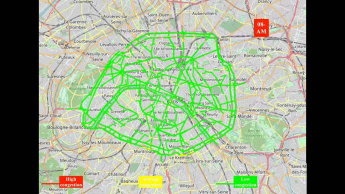
Preliminary results have revealed patterns that most Parisians would recognize, such as high congestion on “Boulevard Périphérique” early in the morning and around 6 PM on working days. However, the data also uncovers other interesting insights, such as unique traffic behaviors in touristic neighborhoods and central business districts.
One particularly intriguing observation is the relationship between occupancy rate (k) and flow (q). It seems that this relationship may offer insights into the geometrical shape of the roads. For instance, changes in the occupancy rate as the flow increases resemble principles from fluid mechanics, where fluid dynamics equations describe the propagation of fluids in various environments. This analogy might provide a deeper understanding of traffic flow behavior in urban networks.
Next Steps:
- Build a forecasting model: The next step is to create a predictive model for each sensor node, aiming to forecast traffic conditions based on historical data.
- Geographical dependencies: Another key area for exploration is how geographical dependencies between nodes can be modeled. For example, a traffic jam in one street at time t-1 often results in congestion in nearby streets shortly after. Modeling these dependencies could significantly improve forecasting accuracy.